Adirondack Paddlers Map Raquette River
Adirondack Paddler’s Map – Raquette River
Part of the Adirondack Paddler’s Map series. Full color, shaded relief and topographic map at a 1:50,000 scale (Approx 1″ =0.8 miles). Shows private land, state land, wilderness designated lands, portages, trails, numbered campsites, and UTM Grids. Measurements are in metric.
Waterproof and tear-resistant material. “18 x 24” format folded to approximately “4 x 9.”
Covers these areas:
- Raquette River
- Blue Mountain Lake
- The Marion River
- Long Lake
- Tupper Lake
- Raquette Lake
Original: $9.95
-65%$9.95
$3.48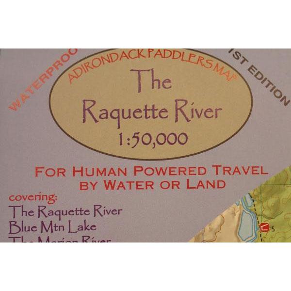
Description
Adirondack Paddler’s Map – Raquette River
Part of the Adirondack Paddler’s Map series. Full color, shaded relief and topographic map at a 1:50,000 scale (Approx 1″ =0.8 miles). Shows private land, state land, wilderness designated lands, portages, trails, numbered campsites, and UTM Grids. Measurements are in metric.
Waterproof and tear-resistant material. “18 x 24” format folded to approximately “4 x 9.”
Covers these areas:
- Raquette River
- Blue Mountain Lake
- The Marion River
- Long Lake
- Tupper Lake
- Raquette Lake